gvSIG bugs #2819

Black area around raster files
| Status: | New | % Done: | 0% | |
|---|---|---|---|---|
| Priority: | Normal | Spent time: | - | |
| Assignee: | - | |||
| Category: | Raster | |||
| Target version: | - | |||
| Severity: | Minor | Add-on version: | ||
| gvSIG version: | 2.1.0 | Add-on build: | ||
| gvSIG build: | 2246 | Add-on resolve version: | ||
| Operative System: | Add-on resolve build: | |||
| Keywords: | Proyecto: | |||
| Has patch: | Hito: | |||
| Add-on name: | Unknown |
Description
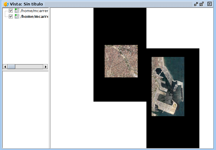
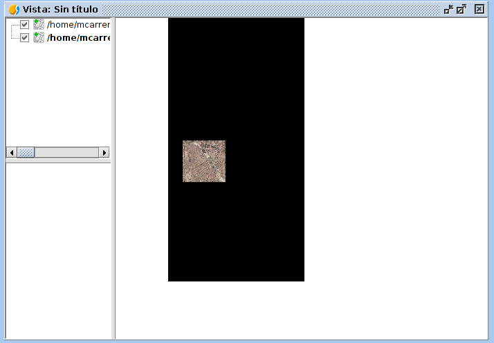
When a raster file is loaded, a black area appears around the extent of the layer. That area changes depending on the zoom.
It doesn't affect the "zoom to layer" tool, it works good.
If we have another layer (raster or not), the black area covers it.
I attach two screenshots with the same layers but two different zooms. In the picture number one, the layer is covered by the black area of the other one.
I also attach the log file.

Related issues
History
#1
 Updated by Álvaro Anguix over 11 years ago
Dato adicional: A mi no me sucede, y uso Ubuntu 64 como Mario.
#2
 Updated by Mario Carrera over 11 years ago
Parece que ocurre cargando la imagen Teselada, no en Normal.
#3
 Updated by Antonio Falciano over 11 years ago
It usually happens with raster formats like JPEG and ECW. It should not depend by the tessellation. For instance, add a WMS layer several time changing the format and you'll notice the differences.
#4
Updated by Antonio Falciano over 11 years ago
Related to #2946.
#5
Updated by Álvaro Anguix over 11 years ago
- Category set to Raster
#6
Updated by Álvaro Anguix about 11 years ago
- Related to gvSIG feature requests #2946: Set NoData values transparent by default added
#7
Updated by Álvaro Anguix about 11 years ago
- Target version set to 2.2.0-2311-rc2
- Assignee set to Francisco Díaz Carsí
#8
Updated by Álvaro Anguix about 11 years ago
- Target version deleted (
2.2.0-2311-rc2)
#9
 Updated by Joaquín del Cerro Murciano almost 10 years ago
- Assignee deleted (
Francisco Díaz Carsí)